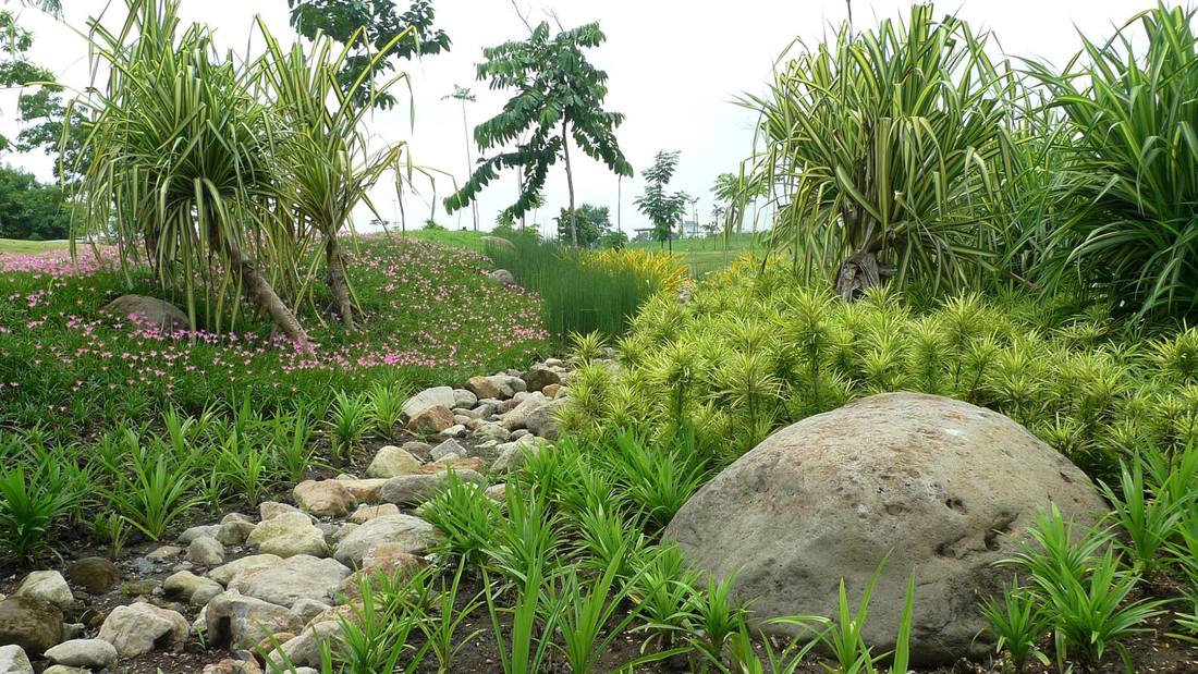
 Part of a series of rain gardens in Santierra Subdivision, located in Nuvali (Sta. Rosa, Laguna) designed by SGS Designs. Photo by Vic Dul-loog (April 2016).  Definition of Green Infrastructure. For today's blog post, we will focus on the integration of “Green Infrastructure” (G.I.) in site planning and modification. No definite meaning is held by the term, however, for this blog post, it shall refer to low-impact physical planning and design that emphasizes on working with nature ( Pötz & Bleuze, 2012). Benefits of Green Infrastructure. G.I. strategies shall be presented in order of implementation scale, in a series of blog post, with corresponding notes on the additional benefits (aside from reduction of water run-off) that are gained when they are integrated in site planning and modification. The following is a matrix of some of their potential benefits, represented by a corresponding symbol:
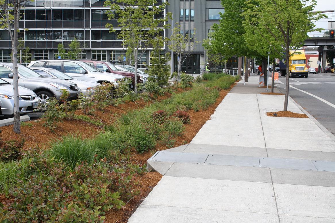
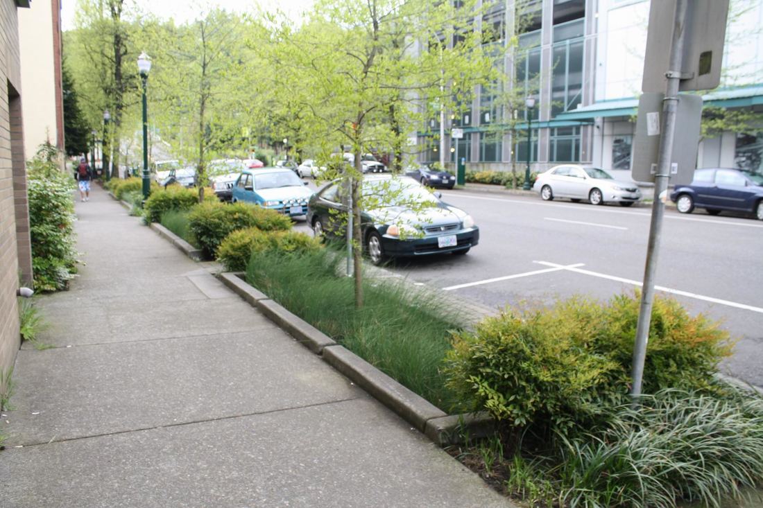
Rain Gardens Definition. A rain garden is a type of bio-retention cell, that is a depressed and porous landscape area in a site that gathers, absorbs and filters water run-off from impervious areas such as roof tops, driveways, walkways, and parking lots (Hinman, 2013). Contrary to common misconception, a rain garden only temporarily accommodates “ponding,” and is not meant to be a permanent pond. Individual lots can introduce rain gardens into sites, and connect to a larger green infrastructure network.
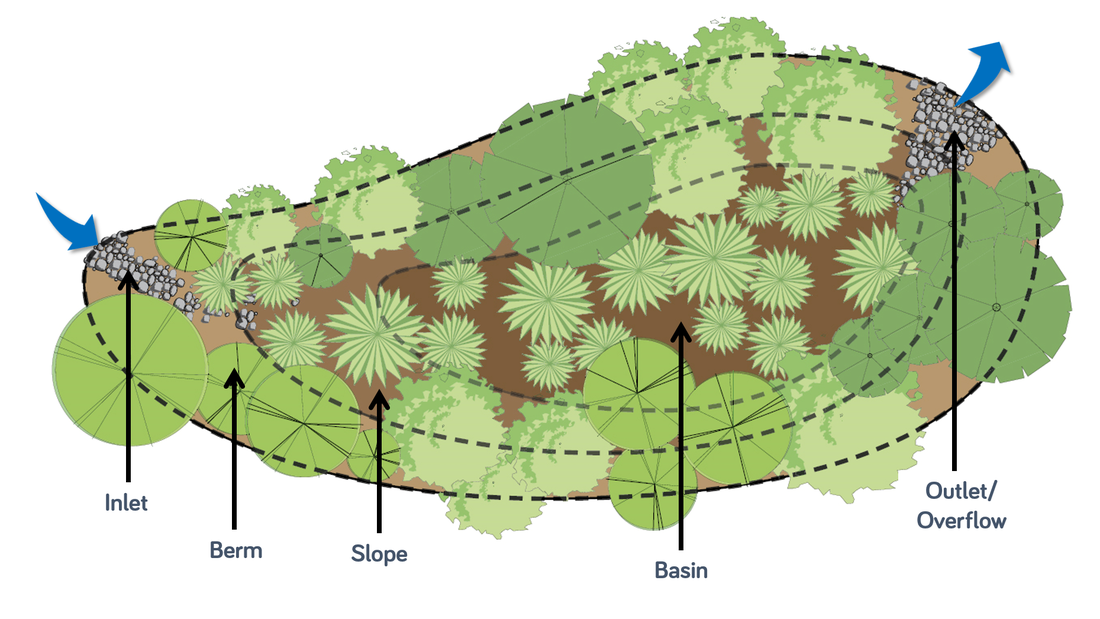 Typical rain garden parts / zones shown in plan. Source: (Cullison) 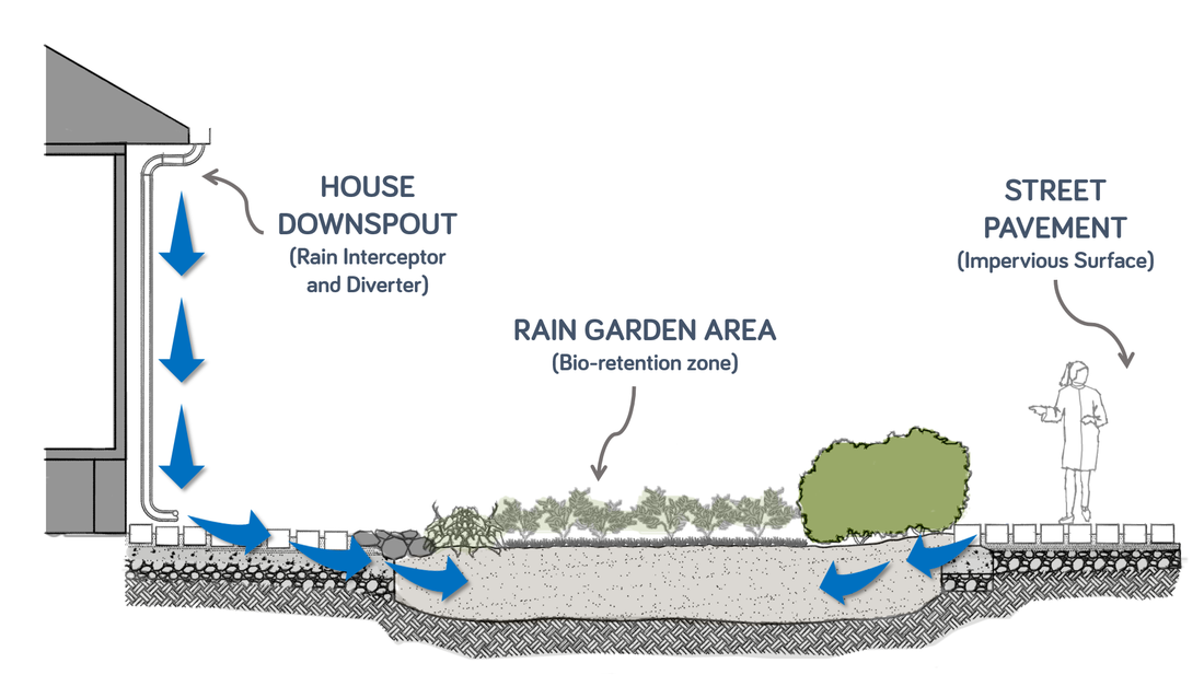 Basic schematic diagram of how a simple rain garden works. Note that overflow or outlet is not shown in this drawing. Image by Wenona Zamora Dagcuta for the BBB Handbook on Disaster Resilient Architecture. 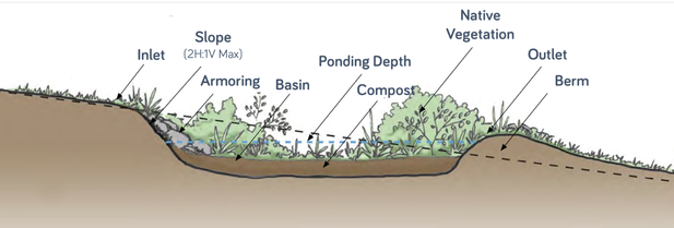 Cross-section showing the typical parts of a common rain garden. Source: (Cullison) Sizing a Rain Garden and Infiltration Rate Requirements Correct sizing is important in the proper function of a rain garden. Below is a simple formula and table to compute for the minimum size of a rain garden. The formula uses the infiltration rate (IR) of the soil, the contributing drainage area (CDA), e.g. roof area, and a corresponding sizing factor based on the previous two data sets. The basic formula is: CDA x Sizing Factor = Min. Area of the Rain Garden  As an example, let us say that the contributing drainage area (CDA) from a roof is forty square meters (40 sqm), and the result of the infiltration rate test for the soil yields an IR of two inches per hour (2 in/hr.); then the minimum area for the rain garden should be at least 2.80 square meters. 40sqm x 7.00% = 2.80 square meters It is important to note however, that most rain garden handbooks require that no rain garden be less than 1.80 square meters (Cullison). Percolation Test. Good quality, fast-draining soil is important so that rain garden area requirement is reduced. If you are unsure of the infiltration rate of your garden soil, you may perform a soil infiltration or percolation test. The ideal soil percolation rate is about one to two inches per hour (Punzi, 2014). Where to Locate Rain Gardens (Hinman, 2013). Aside from choosing an area that can accommodate the area requirements computed, rain gardens should be sited where:
Sample Plant Specimens, with Recommended Rain Garden Location. Here are some plant species that are applicable in the local tropical setting of the Philippines:
 Planting guide for different rain garden zones shown in cross-section. Source: (Cullison) For a more detailed design and comprehensive options, it is best to consult with a licensed Landscape Architect. Just contact the Philippine Association of Landscape Architects. Aside from the use of native vegetation, it is important to follow certain guidelines when choosing and placing vegetation in a rain garden. Proper zoning of plants in the rain garden will ensure that plants will survive and thrive. The image above shows a simple guide for appropriately siting plants based on the zones or locations found in a rain garden. Examples of Applications of Bio-Retention Cells and Rain Gardens
Author: Edra BelgaThis article was finished on July 14, 2017; it will also be appearing in a section of UP-DOST's Build Back Better Handbook on Disaster-Resilient Architecture that will be released this 2017. If you'll be sharing or using this article in your class or any other venue (physical or virtual), kindly make proper attribution to: Edra Belga, and her Memang Mameng Blog at http://memangmameng.weebly.com/ AcknowledgementThank you to the staff of the UP-DOST Build Back Better Program (Jeric, Gab, Kor, Tricia), especially to our Landscape Architect - Wenona Dagcuta for their work in researching references, sourcing images, and even creating our own diagrams. Special thanks also to the professors of UP Diliman College of Architecture - Franklin Fontanoza, Jose Antonio Bimbao and Vic Dul-loog for their valuable inputs on the applications of rain gardens in our tropical setting. And of course, special thanks to Amillah Rodil, my friend, who first inspired me to write on Green Infrastructure since she visited the city of Malmo. Works Cited and Additional Readings:Pötz, H., & Bleuze, P. (2012). Urban Green-Blue Grids for Sustainable and Dynamic Cities. Delft: Coop for Life.
0 Comments
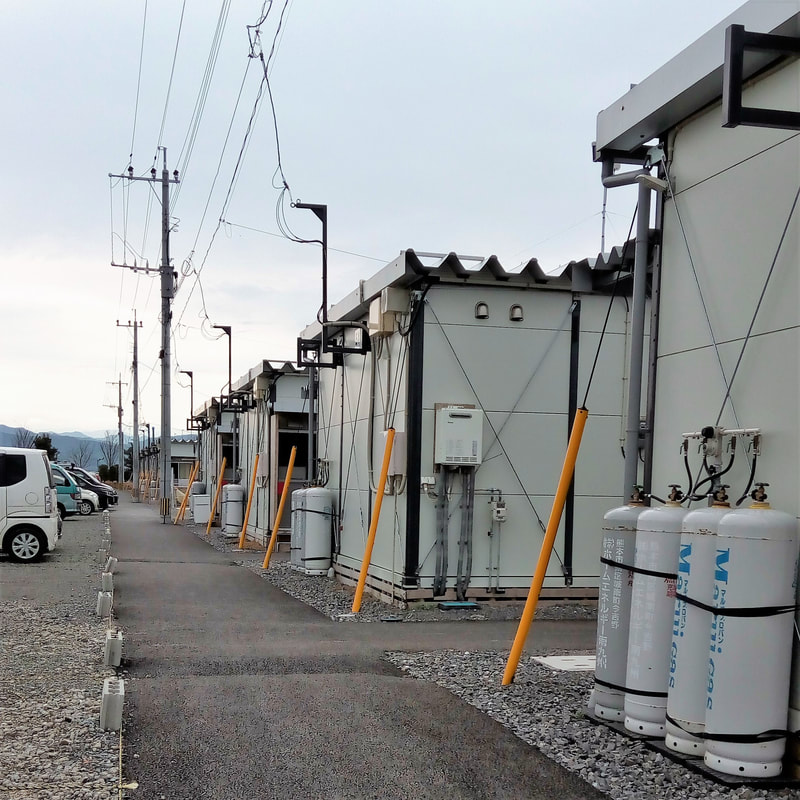
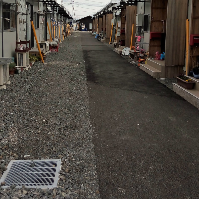
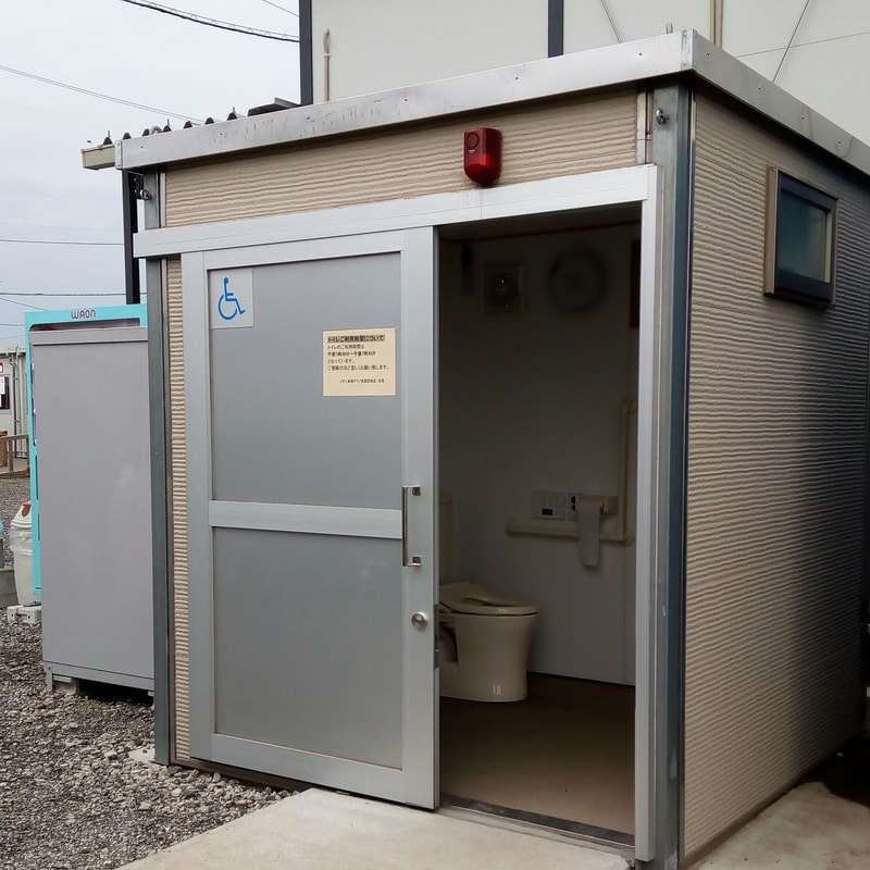
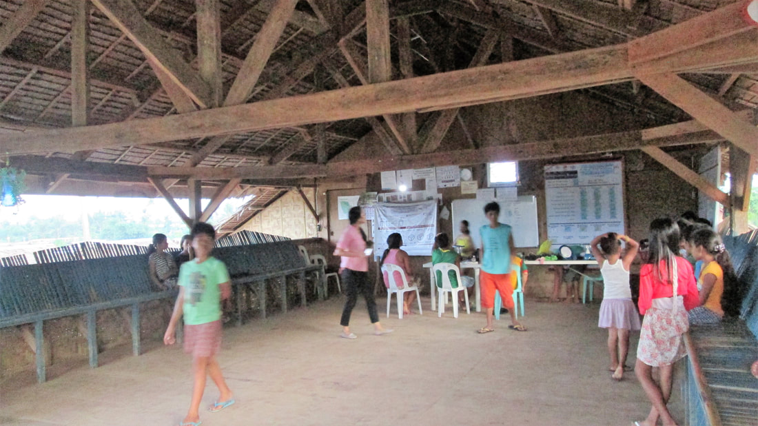
Rethinking Resilience in Emergency Housing: Mashiki-Machi Transient Housing (Kumamoto, Japan)7/12/2017 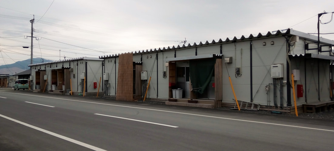 Pre-fabricated container van transient housing units for victims affected by the Kumamoto Earthquake. Photo by Edra Belga (February 2017). Background. Mashiki-Machi Transient Housing was built to accommodate the victims of the 2016 Kumamoto Earthquake from the town of Mashiki. The earthquake struck twice –with a magnitude of six point five (6.50) in the Richter Scale on April 14 , then again with a magnitude of seven point three (7.30) on April 16. One hundred eighty three thousand, and eight hundred eighty two refugees (183, 882) needed urgent shelter. Planning Considerations. The main consideration was the fast deployment of temporary shelter where the refugees will stay for a maximum period of two (2) years while they are undertaking the repair of their original damaged homes, of course with the aid and subsidy from the Japanese government. The relocation area was actually an existing industrial facility. It will be reverted back to its original function once the two-year grace period has expired. To evoke a neighborhood feel, the site was planned much like a scaled-down residential community with features such as commercial shops, clinics, parking areas, bus stops, recreational facilities, and a community center. Sustainability and Resilience Features.
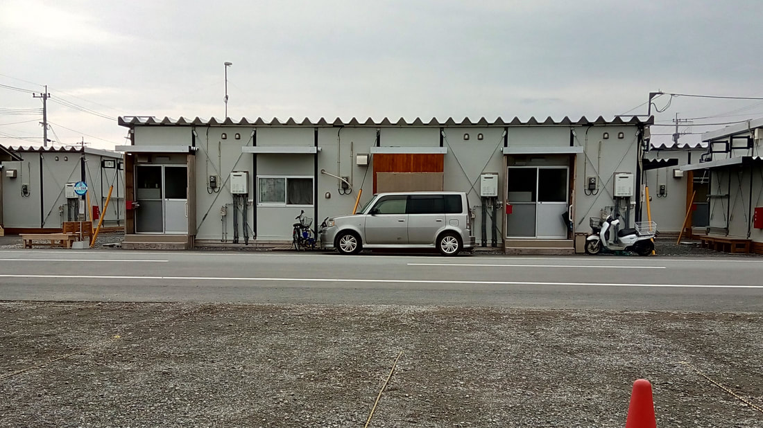 Front elevation of a typical duplex container van fronting the main access road of the relocation site. Photo by Edra Belga (February 2017).
This provides a sense of guarantee that indeed what they are currently experiencing is temporary, and that ultimately they will go back to living their normal life. 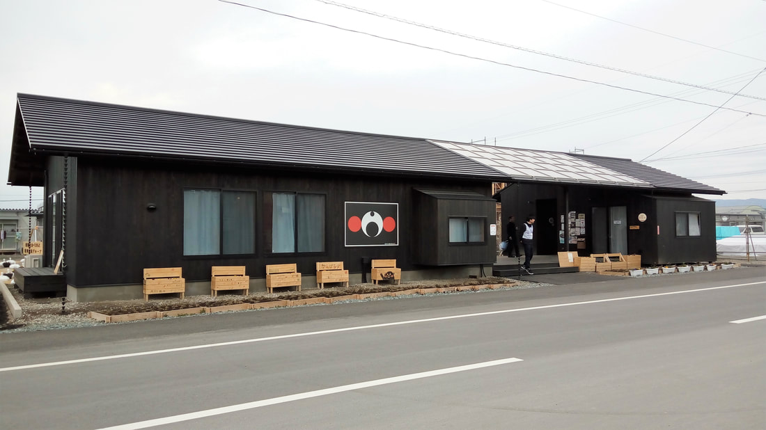 The community center adjacent the main road of the transient housing site. Photo by Edra Belga (February 2017). 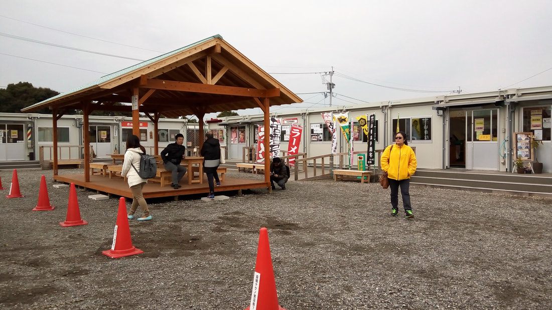 The commercial zone adjacent the community center. A waiting area is seen at the foreground for residents who ride the bus. Photo by Edra Belga (February 2017).
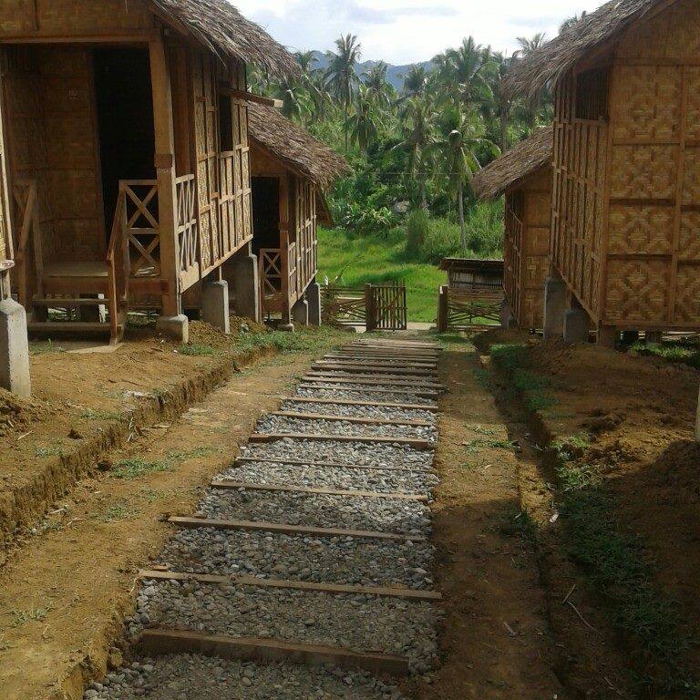
Author: Edra BelgaThis article was written on July 11, 2017. If you'll be sharing or using this article in your class or any other venue (physical or virtual), kindly make proper attribution to: Edra Belga, and her Memang Mameng Blog at http://memangmameng.weebly.com/ AcknowledgementThe author would like to thank the Japan Science and Technology's Sakura Exchange Program and Kyushu University's Enviromental Deign Global Hub for showing us the work they have done to assist the victims of the Kumamoto Earthquake. Special thanks to Dr. Kenichi Tanoue (Kyushu University, Department of Environmental Design) for patiently explaining to us the details of the project. 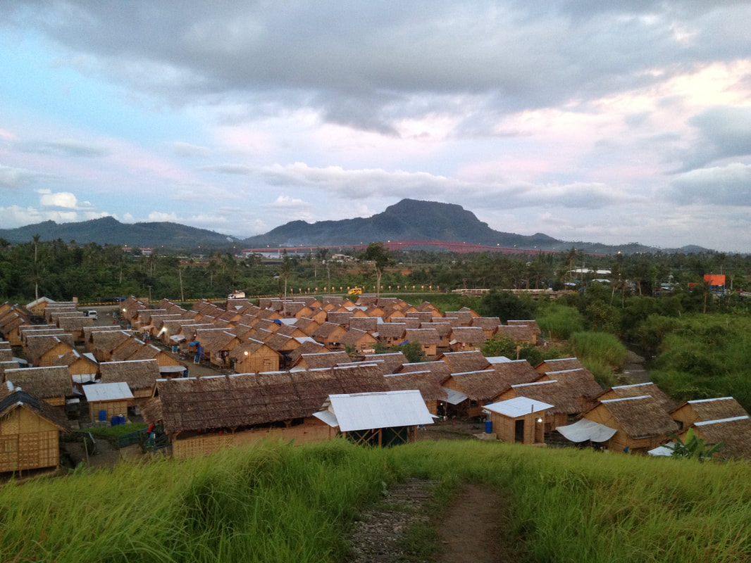 Cali Transitional Site in Tacloban, Leyte . Photo by Jeric Rustia (April 2015). Background. The Cali Transitional Site is a supposed temporary relocation site for victims displaced because of Typhoon Haiyan (“Yolanda”) in 2013. The site was co-sponsored by the International Organization for Migration (IOM), the Government of Nepal, All-Hands Volunteers, Samaritan’s Purse and the Department of Department of Social Welfare and Development (DSWD). The in-land site, provided by the local government unit (LGU), accommodated about 120 households from the coastal area of Barangay 88 in Tacloban City. Planning Considerations. The design and implementation of the project was carried out by IOM, with planning inputs from Architect Amillah Rodil, an alumna of the UP College of Architecture, who was then volunteering for the Tacloban Housing Department. The main challenge was the limitations in time, as site clearing and grading will be performed in a week. The team had to plan quickly, but without compromising the character, basic operations and safety of the site. Sustainability and Resilience Features.
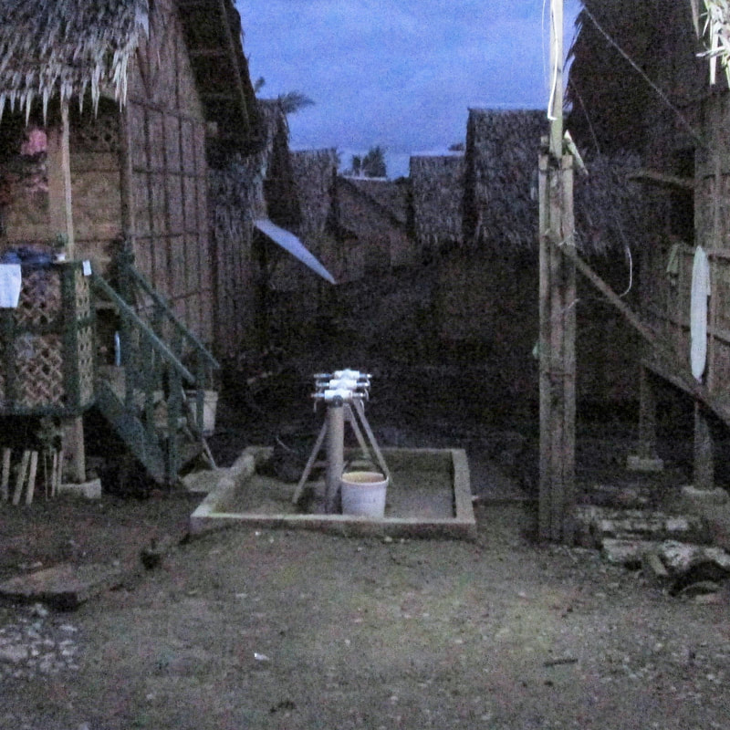
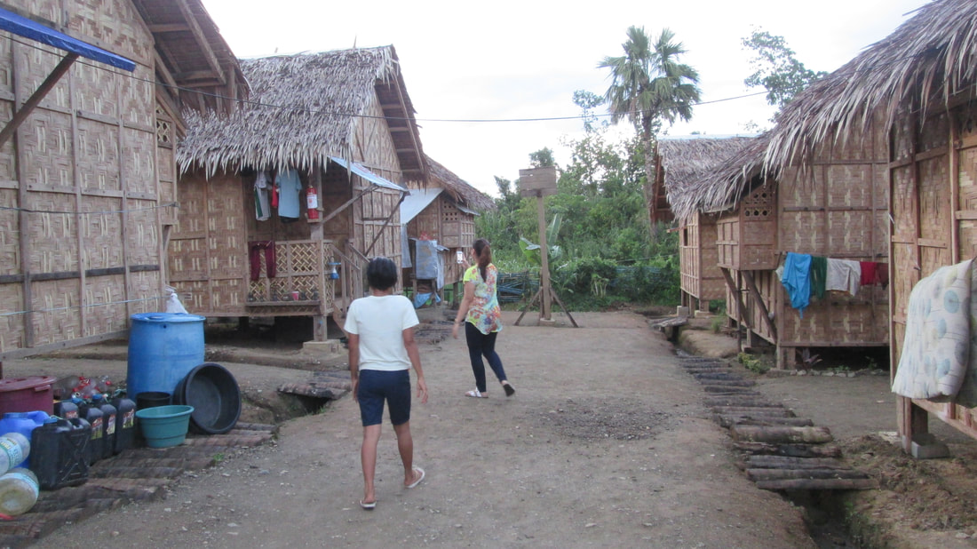 Layout and trenching for drainage at the perimeter of roads and housing clusters has been identified and prioritized during the site preparation. Fallen coconut trees serve as drainage covers. Photo by Edra Belga (April 2015). " The familiarity of the beneficiaries with the native “bahay-kubo” design also ensured that the sponsors can tap the community for manpower resources... Also, there is the added value of the beneficiaries’ sense of ownership and care for the houses they have built themselves. "
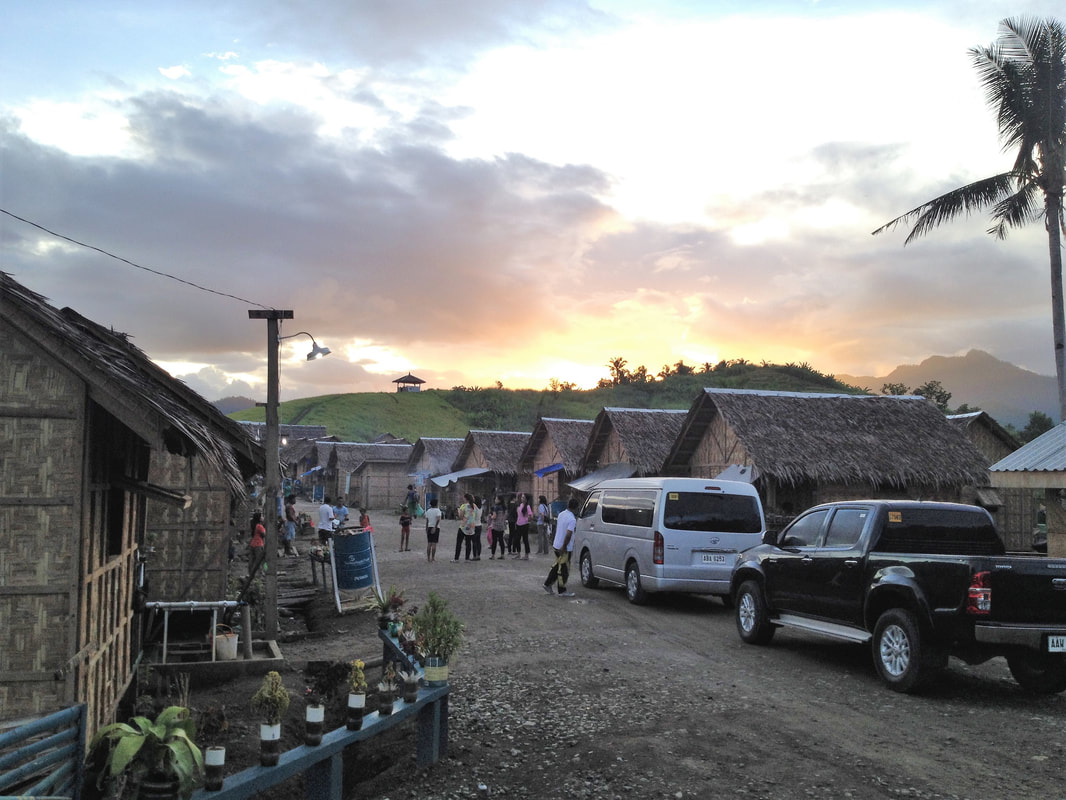 A wide main road about ten meters in width bisects the transitional site and serves as a clear identifiable anchor for evacuation routes. Photo by Jeric Rustia (April 2015).
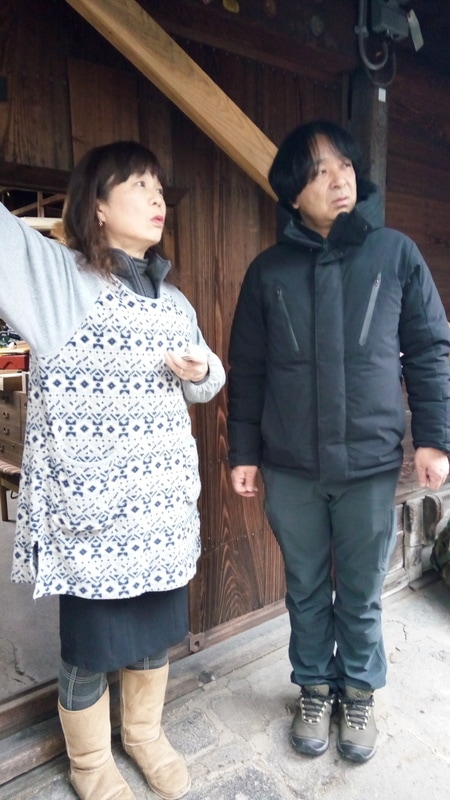
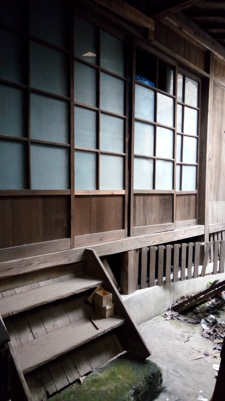
Author: Edra BelgaThis article was written on July 9, 2017. If you'll be sharing or using this article in your class or any other venue (physical or virtual), kindly make proper attribution to: Edra Belga, and her Memang Mameng Blog at http://memangmameng.weebly.com/Write something about yourself. No need to be fancy, just an overview. Now here is a semi-graphical analysis of a truss that I like! It is fast and can be combined with other methods so that you'll be able to compute for the axial forces in different web members in your truss. The trick here is deciding where to slice or "section" your truss. This video will show you how. Again, this is a lecture of mine that was requested by my review students to be uploaded. I'm having a little problem with the volume of the audio and some background noises, but I'm hoping that I can eliminate these in my future videos using audio editing. Anyway, do enjoy and I hope that this would be helpful for those struggling to grasp the concept of semi-graphical truss analysis. #TrussMeIAmAnArchitect or not... ATTRIBUTION: This video was recorded on October 17, 2016. If you'll be sharing or using this video in your class or any other venue (physical or virtual), kindly make proper attribution to: Edra Belga-Casono, and her Memang Mameng Blog at http://memangmameng.weebly.com/ #ArkiReview: Truss Analysis Using Method of Joints and Tips on How to Find Zero Force Members3/17/2017 Still confused about truss analysis without having to solve for reactions first? Here's a video of mine that can hopefully be helpful. A lot of my Architecture Review students have requested that I post my discussion about truss analysis using Method of Joints. They've been particularly confused as to how one can solve for web member axial forces without solving for the truss reactions first. So here, we will also be showing how to find zero-force members so that we will be more efficient with our solutions. So here it is guys. You can play it over again and again until your ears bleed with my voice in your head until you sleep. I hope you can give it a thumbs up rating. Thank you. :) ATTRIBUTION: This video was recorded on October 15, 2016. If you'll be sharing or using this video in your class or any other venue (physical or virtual), kindly make proper attribution to: Edra Belga-Casono, and her Memang Mameng Blog at http://memangmameng.weebly.com/ As an Architect, I always read the news about demolition of heritage buildings and desecration of historical landmarks. Seeing depictions of these sites' glorious past, and imagining what future stories they can still tell make me feel strongly against these. I get it. How could other people see otherwise? But there is another side to cultural heritage preservation, that has rarely been talked about. I've had the opportunity to witness the situation of common people who are struggling to persist in this post-modern world and keep their traditional way-of-life in tact. Let's first take a look at Machiya Houses in Kumamoto, Japan. A traditional Machiya, can be a shop-house for the sales of different wares, or the home of an artisan. Clusters of Machiya Houses, would comprise a merchant district. When visiting Japan, experiencing or even just seeing Machiya Houses evokes old-world charm and nostalgia. However, more and more, Machiya Houses are becoming a rarity in the streetscapes of Japanese cities. 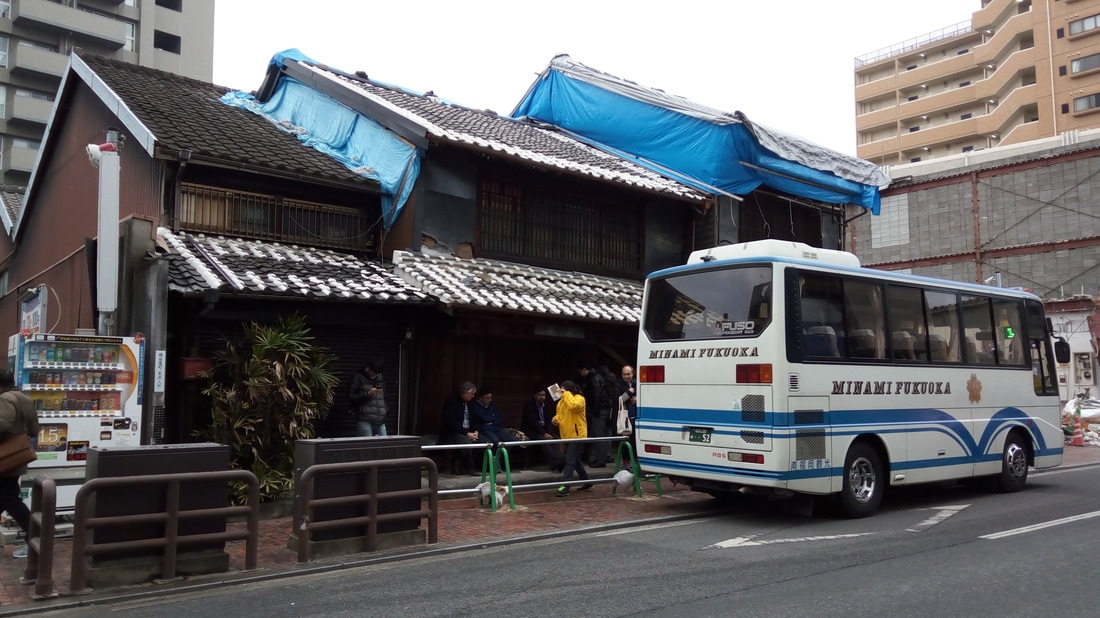 A traditional Machiya in Fukuoka that will be demolished, since the owner decided that she can no longer keep it. Private Burden. I was surprised when I visited Kumamoto to learn that machiyas can still belong to the direct descendants of the original owners. I also learned that upkeep or maintenance of these centuries-old machiyas are considered private obligations with little support from the government or other funding institutions. Somehow, I had this assumption that Japan is a paradise where there is always support and incentive for those who would like to preserve their cultural heritage. Well, myth busted.
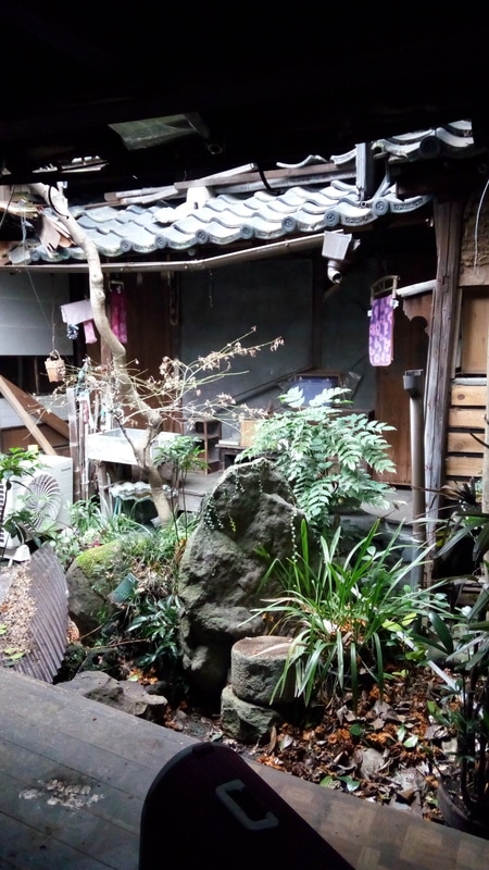
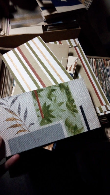
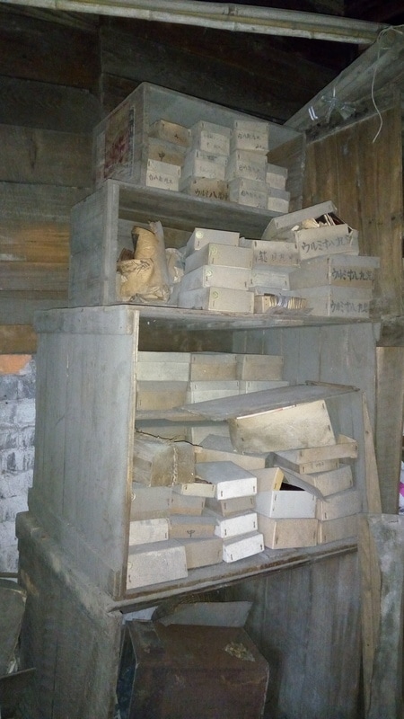
Demolishing Rather Than Keeping. We met a lady living in the traditional Machiya district of Kumamoto, she was introduced to us by Dr. Kenichi Tanoue of Kyushu University, a native of Kumamoto and a community architect helping in the preservation of local Machiya Houses. She owns a 400 year-old machiya, near Kumamoto Castle, and sells specialized fabric and stationery. However, maintaining her business has become difficult, as tourism's benefit is unable to trickle down to local shop-houses. Aside from the upkeep of her business and machiya, she also has to pay land tax, which they note as quite exorbitant. Eventually, she decided to let go of her machiya. The government will then shoulder the expenses of the demolition. Afterwhich, she will be able to move into a smaller apartment and find an alternative form of employment that will be a more sustainable option.
"Eventually, she decided to let go of her machiya. The government will shoulder the expenses of the demolition. She will be able to move into a smaller apartment and find an alternative form of employment that will be a more sustainable option." Even as part of me was saddened by the loss of a centuries-old traditional vernacular Japanese house. It made me realize that cultural heritage preservation must go beyond mere preservation of the physical structure. The reason why we still see heritage buildings and districts is because their custodians not only see the value in them, but also benefit from them. As an Architect, I may see the value in preserving a heritage building, but hearing the stories of the people at the ground, made me step down from my ivory tower. Bottom line is that people are the basic units of cultural heritage. We may romanticize and wish to make time stand still, but reality is that times have changed and will continue to change. Unless people are made to benefit from their own cultural heritage, these traditional vernacular houses will merely become rare relics of the past. "people are the basic units of cultural heritage... Unless people are made to benefit from their own cultural heritage, these traditional vernacular houses will merely become rare relics of the past."
|
Who is Mameng?Mameng is a feisty "Biday" who has a lot to say about things, but will not comment on her love life. 
ArchivesCategories
All
|


 RSS Feed
